

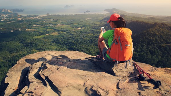
Digital world step for the people who are in Adventure. You know when you’re hiking and your quadriceps start burning, your feet are sore and you’re ravenous because Luna bars aren’t actually a meal? It’s happened to me too many times to count. I’m an active person — I like to run, bike and hike in moderate amounts, but I need to know what I’m getting myself into. In other words, spontaneous 7-mile hikes aren’t really my thing. In the interest of conflict avoidance, my friends used to tell me we were going on much shorter hikes, and I wouldn’t discover the trail’s true distance until it was too late to turn back.
No doubt, Google Maps has some hiking trails mapped out, but AllTrails is the only app I’ve used that has highly detailed route information for millions of trails all over the world. Now when someone suggests a hike, I look it up on the app so I know exactly how long it is and how much elevation I’ll encounter. There are also user-uploaded photos of scenic viewpoints along the route. You can choose your own adventure depending on what you’re in the mood to see that day — oceans, trees, mountains or all three.
AllTrails is how I discovered the Emigrant Wilderness Loop Trail near Pinecrest, California. It’s a moderate hike in the mountain with snow on the ground in some places even in summer thanks to the high elevation. When you reach the top, you’ll find stunning views of the Stanislaus National Forest.
THE APP IS IN 102 COUNTRIES, INCLUDES 10,000 NATIONAL PARKS AND HAS AN EVEN SPLIT BETWEEN THE NUMBER OF MALE AND FEMALE USERS.
The app wasn’t always for moderate hikers. When Russell Cook founded AllTrails in 2010, it was aimed at hardcore backpackers, search and rescue crews and trail runners. As the company scaled up, it decided to make inclusivity part of its strategy. “We wanted to make the outdoor experience accessible for anyone — even if you’ve never put on hiking boots before,” says Ron Schneidermann, AllTrails chief operating officer and chief management officer. When Schneidermann joined the company in 2015, it began prioritizing accessibility: showing precise locations for trailheads, as well as the length and difficulty level of each trail.
This is one of my favorite features of the app — but sometimes difficulty level is subjective. Some routes labeled “moderate” would certainly be classified as “hard” in my mind (or maybe I’m just out of shape).
AllTrails also has features that help after the trek is over. Have you ever done a hike and then promptly forgotten what it’s called and any other pertinent information? If you have the Pro version ($30 per year; $99.99 for lifetime access), you can track your route, save it to your profile and share it with friends. The app is now in 102 countries, includes 10,000 national parks and has an even split between the number of male and female users.
FunFun hiking outings aside, AllTrails also has some seriously helpful features. In August, it launched Lifeline for Pro users. You can send designated safety contacts a map of your planned route and update them on your location, and they’ll get emergency alerts if you stray too far off the path. On Google Play and Twitter, users have commented that Lifeline has literally saved their lives while hiking.
This year, AllTrails will become even more of a collaborative tool. While they haven’t finalized the plan yet, Schneidermann and his team want to give users the ability to easily communicate and plan treks with their group on the app. The company also plans to become more global by creating app versions in Spanish, French and German. And investors are confident in the company’s vision — in October, AllTrails received $75 million in funding from Spectrum Equity.
If you like hiking, trail running or mountain biking, even moderately, AllTrails makes prep easier and less stressful so you can do what you’re meant to do on the trail — enjoy being in nature.


")


